Back ستانوود (واشنطن) Arabic ستانوود (سنوهوميش) ARZ استن وود، واشینقتون AZB Стануд Bulgarian Stanwood (Washington) Catalan Станвуд (Вашингтон) CE Stanwood (lungsod sa Tinipong Bansa, Washington) CEB Stanwood, Washington Welsh Stanwood, Washington English Stanwood (Washington) Spanish
| Stanwood | ||
|---|---|---|
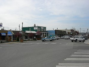
 Blick nach Westen auf der Main Street | ||
| Lage in Washington | ||
|
| ||
| Basisdaten | ||
| Gründung: | 19. Oktober 1903 (incorporated, d. h. als Gebietskörperschaft anerkannt) | |
| Staat: | Vereinigte Staaten | |
| Bundesstaat: | Washington | |
| County: | Snohomish County | |
| Koordinaten: | 48° 15′ N, 122° 21′ W | |
| Zeitzone: | Pacific (UTC−8/−7) | |
| Einwohner: | 7.705 (Stand: 2020) | |
| Haushalte: | 2.609 (Stand: 2020) | |
| Fläche: | 7,36 km² (ca. 3 mi²) davon 7,30 km² (ca. 3 mi²) Land | |
| Bevölkerungsdichte: | 1.055 Einwohner je km² | |
| Höhe: | 2 m | |
| Postleitzahl: | 98292 | |
| Vorwahl: | +1 360 | |
| FIPS: | 53-67455 | |
| GNIS-ID: | 1512690 | |
| Website: | www.ci.stanwood.wa.us | |
| Bürgermeister: | Leonard Kelley | |
 Lage von Stanwood im Snohomish County | ||

Stanwood ist eine Stadt (City) im Snohomish County im US-Bundesstaat Washington. Im Lushootseed wird Stanwood: Sŭl-gwähs’ genannt.[2] Die Stadt liegt etwa 80 km nördlich von Seattle an der Mündung des Stillaguamish River in den Puget Sound. Zum United States Census 2020 hatte Stanwood 7.705 Einwohner.[3]
- ↑ Prasse, Karen. River, Rail, & Road A Pictorial History of Stanwood & East Stanwood, Washington. Stanwood, Wash: Stanwood Area Historical Society, 2003.
- ↑ Herbert Hunt, Floyd C. Kaylor: Washington, West of the Cascades: Historical and Descriptive. S. J. Clarke Publishing Company, Chicago 1917, OCLC 10086413, S. 395–398, 534 (Google Books [abgerufen am 24. April 2017]).
- ↑ U.S. Census Bureau QuickFacts: Stanwood city, Washington. Abgerufen am 27. Februar 2022 (englisch).
